The Grid That Grew Old: Why Britain's Coordinate System Is Struggling to Keep Pace With a Precision-Hungry World
The Grid That Grew Old: Why Britain's Coordinate System Is Struggling to Keep Pace With a Precision-Hungry World
There is something quietly remarkable about the Ordnance Survey National Grid. Conceived in the 1930s, formally adopted in the 1940s, and used without fundamental revision ever since, it has underpinned the mapping of an entire nation through the age of paper, through the transition to digital, and into the era of satellite navigation. It is, in the most literal sense, the coordinate fabric of Britain.
And it is beginning to show its age.
This is not a criticism that can be levelled lightly. The National Grid — a transverse Mercator projection anchored to a false origin southwest of the Isles of Scilly, expressed as eastings and northings in metres — is an elegant piece of applied mathematics that has served its purpose with remarkable fidelity. But the purposes it was designed to serve, and the purposes to which location technology is now being put, are separated by a gulf that grows wider with each passing year.
What the Grid Was Built to Do
The National Grid was designed for human navigators working with paper maps at scales between 1:25,000 and 1:250,000. At those scales, a positional uncertainty of a metre or two is imperceptible. The grid reference system — expressing locations as letter-prefixed numeric codes such as TQ 3012 8056 — was intended to allow a person with a map and a compass to locate themselves within a defined square. It was never intended to anchor a robot to the physical world with sub-centimetre fidelity.
The grid's underlying geodetic datum, OSGB36, was computed from triangulation observations made across Britain in the nineteenth and early twentieth centuries. It is not a perfect representation of the Earth's shape. It contains accumulated distortions — some as large as several metres in the horizontal plane — that arise from the limitations of classical survey methods. These distortions are well-characterised and have been modelled in the OSTN15 transformation, which allows conversion between OSGB36 and the global ETRS89 datum used by GNSS receivers. But the existence of that transformation is itself an acknowledgement that the National Grid is not the same thing as the physical world.
Where Modern Applications Are Hitting the Ceiling
For a surveyor producing a site plan or a GIS analyst mapping administrative boundaries, the difference between OSGB36 and ETRS89 is a manageable technical consideration. For an autonomous vehicle navigating at 70 miles per hour, or a drone conducting a precision infrastructure inspection, or a robotics system performing centimetre-accurate ground operations, it is something more consequential.
Dr Sarah Whitmore, a geodetic scientist at University College London's Department of Civil, Environmental and Geomatic Engineering, describes the issue in terms of what she calls 'datum friction'. 'Every time a modern positioning system — which is inherently working in a global reference frame — needs to interact with a dataset expressed in the National Grid, there is a transformation step,' she explains. 'That step introduces uncertainty. In most applications, that uncertainty is trivial. In applications where centimetre accuracy is operationally critical, it is not.'
The autonomous vehicle sector is perhaps the most visible pressure point. High-definition mapping for autonomous driving requires absolute positional accuracy — not just relative accuracy within a local area, but accuracy in a global reference frame that allows a vehicle's real-time GNSS position to be matched against its pre-surveyed HD map with confidence. The National Grid is not inherently incompatible with this requirement, but the transformation overhead and the variable accuracy of OSTN15 across different parts of Britain create complications that HD mapping vendors must address individually and inconsistently.
The Drone and Robotics Dimension
The UK's drone sector — now one of the largest in Europe by commercial operator count — presents a related but distinct challenge. Beyond Visual Line of Sight operations, which the Civil Aviation Authority is progressively enabling through its regulatory framework, depend on precise geographic deconfliction: knowing, to a level of certainty that supports safety-critical decisions, exactly where each drone is operating relative to controlled airspace, infrastructure corridors, and other airspace users.
James Calloway, a geomatics engineer who has worked on BVLOS certification programmes for two major UK drone operators, describes a recurring frustration. 'We're building operational volumes — the three-dimensional spaces within which a drone is authorised to fly — and those volumes need to be expressed in a coordinate system that our aircraft's positioning system, the airspace management platform, and the regulator's databases all interpret identically. When you're working across systems that have different approaches to the OSGB36-to-ETRS89 transformation, you can end up with operational volumes that don't quite align. At the margins, that matters.'
The problem is compounded by the vertical dimension. The National Grid is a two-dimensional system. Heights in British mapping are expressed relative to Ordnance Datum Newlyn — mean sea level as measured at Newlyn in Cornwall — using a geoid model called OSGM15. For applications requiring precise three-dimensional positioning, the interaction between horizontal datum, vertical datum, and global GNSS reference frames creates a tripartite transformation challenge that even experienced geodesists approach carefully.
The Infrastructure Survey Problem
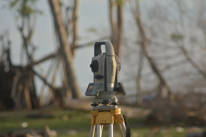
Britain's utilities and infrastructure operators are conducting an increasing volume of high-frequency, high-precision surveys using mobile mapping systems, terrestrial LiDAR, and UAV-mounted sensors. The outputs of these surveys — point clouds, georeferenced imagery, extracted feature datasets — are being used to detect millimetre-scale changes in asset condition over time: subsidence in railway embankments, deformation in retaining walls, settlement in bridge abutments.
Change detection at this precision requires that surveys conducted at different times, potentially by different contractors using different equipment, can be meaningfully compared. That comparison is only reliable if all surveys are expressed in a consistent, stable reference frame. The National Grid, anchored to OSGB36, is not perfectly stable: tectonic movement means that the relationship between OSGB36 coordinates and physical positions on the Earth's surface changes slowly over time. For annual surveys of a bridge, this is irrelevant. For a programme of continuous structural monitoring where millimetre-scale change is the signal of interest, it is not.
Is Britain Ready for the Conversation?
Ordnance Survey is acutely aware of these pressures. Its National Geodetic Infrastructure programme, and the development of the Inertial Navigation Geodesy network, reflect a serious institutional engagement with the limitations of the existing datum framework. The OS Net GNSS reference station network provides the infrastructure for high-accuracy real-time positioning in ETRS89. The OSTN15 and OSGM15 transformations are technically sophisticated products.
But the question that the geospatial community has been reluctant to ask publicly is whether these measures — valuable as they are — represent an adequate response to the scale of change that is coming, or whether they are sophisticated workarounds that defer a more fundamental reckoning.
Professor Alan Trigg, a former adviser to the Royal Institution of Chartered Surveyors on geodetic matters, argues for candour. 'The National Grid is not broken. It works well for the vast majority of applications. But we are entering a period in which location-dependent technologies will become critical national infrastructure — autonomous transport, precision agriculture, robotic construction, smart utility networks. The coordinate system that underpins those technologies needs to be fit for purpose not just today, but for the next fifty years. That is a conversation Britain needs to have openly, and it needs to involve not just geodesists but the industries that will depend on the answer.'
What Comes Next
There is no credible proposal, from Ordnance Survey or elsewhere, to abolish or replace the National Grid in the near term. The inertia embedded in decades of spatial data, legal documentation, and institutional practice is simply too great. What is emerging, however, is a pragmatic parallel architecture: a world in which the National Grid remains the legal and administrative reference system, whilst operational location-dependent applications increasingly work natively in global reference frames — ETRS89 for horizontal positioning, a modernised vertical datum for height — and transform into National Grid coordinates only when required for administrative purposes.
Whether that architecture is sufficient, or whether it merely displaces the fundamental tension rather than resolving it, is a question that Britain's geospatial community is only beginning to examine with the seriousness it deserves. The grid that has served this nation faithfully for seven decades is not about to fail. But the world it was built to describe has changed, and the map — as it has always done — must follow.