Fields of Data: The Yawning Gap Between Precision Agriculture and Britain's Land Classification System
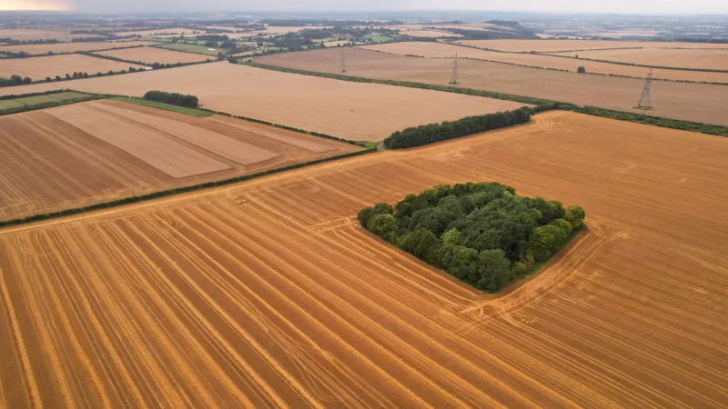
On a farm in Lincolnshire, a drone completes its third pass of the morning, capturing multispectral imagery at five-centimetre resolution. Back in the farmhouse, software translates that imagery into a variable-rate fertiliser application map, identifying nitrogen-deficient patches with a spatial accuracy that would have seemed extraordinary a decade ago. The farmer's agronomist reviews the data on a tablet, adjusts the prescription, and schedules the application vehicle before lunch.
Thirty miles away, a planning officer consults the Agricultural Land Classification map to assess whether a proposed development might affect Grade 1 farmland. The map she is consulting was surveyed between 1966 and 1974. It was not designed to distinguish between a field managed with precision variable-rate inputs and one managed with blanket applications. It does not capture drainage improvements, soil remediation works, or the yield transformation that modern precision techniques have delivered. In the eyes of the planning system, both fields are simply Grade 2.
This is not a minor bureaucratic inconvenience. It is a structural data failure with direct consequences for food security, rural development policy, and Britain's ability to compete in a global agricultural economy that is rapidly stratifying by technological sophistication.
The Classification System's Conceptual Limits
England's Agricultural Land Classification, administered by Natural England, grades agricultural land from Grade 1 (best and most versatile) through to Grade 5 (land of very limited agricultural value). The system was designed to provide a broad strategic picture of soil quality and climatic suitability — a reasonable objective for 1960s land use planning, when farming was a less technologically differentiated activity.
However, the classification captures inherent land capability, not managed agricultural performance. It does not account for the transformative effect of drainage investment, organic matter improvement, or the precision management techniques that now allow a Grade 3b field to consistently outperform an unmanaged Grade 2 holding. Nor does it reflect the spatial heterogeneity that modern sensors reveal within individual fields — a single ALC polygon may conceal soil variability that precision agriculture manages at sub-10-metre resolution.
The consequence is that planning decisions affecting agricultural land are routinely made using data that misrepresents the economic and productive reality of the affected parcels. A field that a farmer has invested heavily in improving may be classified identically to an adjacent, neglected one. A development proposal may be assessed as affecting Grade 3b land — nominally acceptable for release — when modern agronomic data would demonstrate that the land's actual productivity places it in a different strategic category entirely.
Satellite Intelligence Meets Paper Polygons
The contrast between what farmers now know about their land and what planning systems record is stark. Platforms such as Trimble, John Deere Operations Center, and various UK-developed agri-tech solutions routinely integrate Sentinel-2 and commercial satellite imagery with yield mapping data, soil electrical conductivity surveys, and historical weather records to produce field-level management insights of considerable sophistication.
The Rural Payments Agency's land parcel data — maintained through the Rural Land Register — provides a reasonable spatial framework for agricultural subsidy administration, but it is not designed to carry agronomic performance information. The result is a disconnect: Britain's farmers are generating some of the richest field-level geospatial data in the world, yet none of it informs the planning or policy frameworks that govern how that land can be used, protected, or developed.
This matters particularly in the context of the Agricultural Transition Plan and the shift from area-based payments to the Environmental Land Management scheme. Properly integrated geospatial data — combining ALC, precision agronomic records, and remote sensing outputs — could enable genuinely targeted agri-environment policy, directing public money towards land where the environmental benefit is greatest without unnecessarily compromising the most productive agricultural areas. Without it, policy instruments remain blunt.
Development Pressure and the Data Vacuum
The planning implications extend beyond subsidy policy. England loses approximately 600 hectares of agricultural land to development each year, according to figures compiled from land use change statistics. The adequacy of ALC as the primary protective instrument for the most productive farmland is increasingly questioned by agricultural economists and rural planners.
When a local planning authority assesses a major housing or logistics development proposal, the ALC map provides a broad indication of land quality. But it does not capture whether the affected land is within a precision-managed operation whose loss would have disproportionate supply chain effects, whether the soil has been subject to recent improvement investment, or whether the parcel forms a critical contiguous block within a larger farming enterprise. These are precisely the factors that a modern geospatial analysis, drawing on precision agriculture datasets, could illuminate.
The absence of this data does not merely make planning decisions less well-informed; it systematically disadvantages farmers who have invested in their land's productive capability, since that investment is invisible to the regulatory framework.
Building the Agricultural Geospatial Bridge
Several routes towards a more coherent agricultural geospatial framework have been proposed within the sector. Agri-tech organisations have advocated for a voluntary farm data commons — a secure, anonymised repository of precision agriculture data that could inform national-level analysis without compromising individual farm commercial confidentiality. The Geospatial Commission's work on data sharing frameworks provides a potential governance model.
At the operational level, Defra's data infrastructure investments, including the expanded Rural Land Register and the developing Farm Assurance data systems, offer a foundation on which more sophisticated integration could be built. What is currently lacking is the political impetus to connect these threads into a coherent national agricultural geospatial strategy.
Britain has invested substantially in agri-tech capability. Its universities produce world-class precision agriculture research. Its farm machinery sector is among the most technically advanced in Europe. Yet the data systems that should translate farm-level intelligence into national food security planning remain, in critical respects, decades behind the technology being deployed in the fields they purport to describe.
The land does not wait for the paperwork to catch up.