Digital Archaeology: Racing to Map Britain's Vanishing Heritage Before Development Erases History
The Invisible Heritage Crisis
Beneath Britain's modern landscape lies a hidden archaeological treasure trove—thousands of historic sites, ancient boundaries, and culturally significant locations that exist in a peculiar form of geographic limbo. While these sites are documented in dusty archives, academic papers, and local historical records, they remain absent from the authoritative digital mapping layers that guide contemporary planning decisions, development approvals, and conservation efforts.
This geographic invisibility has created an unprecedented threat to Britain's cultural heritage. As development pressure intensifies across the country, countless historic sites are being lost not through deliberate destruction, but through simple ignorance—planners, developers, and local authorities operating with incomplete spatial intelligence that fails to reveal the archaeological and cultural significance of seemingly ordinary landscapes.
The race is now on to bridge this gap between analogue heritage records and digital geographic systems before physical degradation and development pressure erase these irreplaceable cultural assets entirely.
The Paper Trail Problem
Britain's heritage documentation represents one of the world's most comprehensive archaeological records, spanning millennia from Neolithic monuments to post-industrial structures. Yet this wealth of knowledge remains largely trapped in formats that modern geographic intelligence systems cannot easily access or integrate.
County Records Offices, university archives, and heritage organisations hold millions of documents describing the locations and significance of historic sites. However, these records typically use obsolete reference systems, imprecise descriptive locations, or coordinate systems that predate modern GPS technology. A Victorian antiquarian's description of "the ancient earthwork three furlongs south-east of the old mill beyond Blackthorn Common" may represent invaluable cultural intelligence, but translating such references into modern mapping coordinates requires painstaking detective work that few heritage organisations can afford to undertake systematically.
This translation challenge becomes particularly acute when dealing with sites that have been altered or obscured by centuries of agricultural activity, urban development, or natural processes. Medieval field systems visible in eighteenth-century estate maps may survive as subtle archaeological features detectable only through sophisticated remote sensing, yet remain invisible to planners working with standard topographic mapping.
The Development Threat
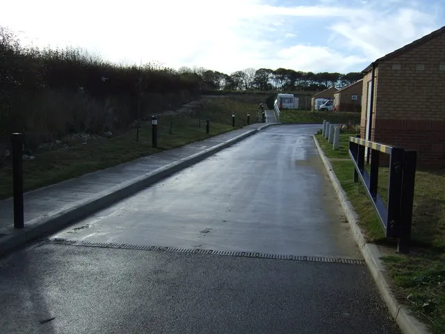
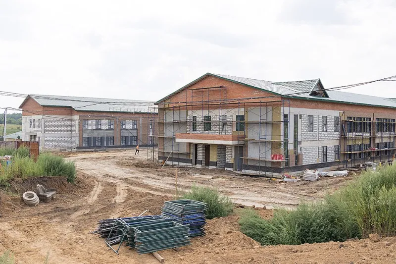
The consequences of this heritage mapping gap are becoming increasingly severe as development pressure intensifies across Britain. Planning applications routinely proceed without full awareness of the archaeological and cultural significance of affected sites, leading to irreversible losses that could be prevented with better spatial intelligence.
Recent examples include the partial destruction of a Roman villa site in Oxfordshire that was known to local archaeologists but not recorded in the planning authority's GIS database, and the loss of medieval ridge-and-furrow field systems in Leicestershire that survived for eight centuries before disappearing under a housing development approved without adequate heritage assessment.
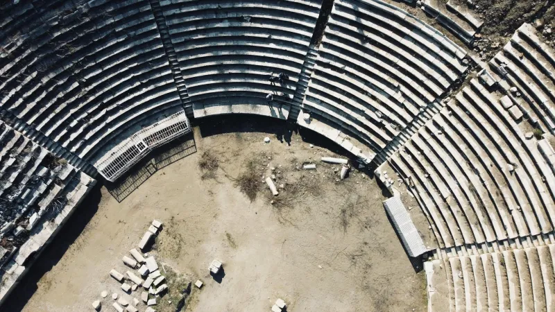
These losses represent more than academic concern—they constitute the erasure of irreplaceable evidence about how previous generations of Britons lived, worked, and shaped the landscape. Each destroyed site removes a piece of the complex puzzle that archaeologists and historians use to understand Britain's cultural evolution.
The LiDAR Revolution
Fortunately, advances in remote sensing technology are providing new tools for heritage mapping that can reveal archaeological features invisible to conventional survey methods. Light Detection and Ranging (LiDAR) technology, which uses laser pulses to create highly detailed elevation models, has revolutionised archaeological prospection by penetrating vegetation cover to reveal subtle topographic features that indicate buried or damaged historic sites.
Environment Agency LiDAR coverage across England has already revealed thousands of previously unknown archaeological sites, from Bronze Age barrows hidden beneath modern woodland to the remains of deserted medieval villages obscured by centuries of agricultural activity. However, translating these discoveries into actionable heritage protection requires sophisticated analysis and ground-truthing that many local authorities lack the resources to undertake.
Pioneering projects like the New Forest National Park Authority's heritage mapping initiative demonstrate how LiDAR data can be systematically analysed to create comprehensive archaeological landscapes. By combining high-resolution elevation data with historical mapping, aerial photography, and archival research, these projects are producing detailed heritage inventories that can inform planning decisions and conservation priorities.
Citizen Science and Crowdsourced Heritage
The scale of Britain's heritage mapping challenge far exceeds the capacity of professional archaeological services, leading to innovative approaches that harness citizen science and crowdsourced intelligence. Projects like the Portable Antiquities Scheme have demonstrated how volunteer contributions can create valuable archaeological databases, while initiatives such as Heritage Gateway are working to make existing heritage records more accessible and geographically precise.
Local history societies, metal detecting groups, and amateur archaeologists possess intimate knowledge of their local landscapes that often surpasses official records. By providing these communities with tools to record and share their discoveries using modern GPS technology, heritage organisations are creating comprehensive spatial databases that capture both known sites and new discoveries.
The success of projects like Megalithic Portal, which has crowdsourced the locations of thousands of ancient monuments across Britain, demonstrates the potential for community-driven heritage mapping. However, ensuring the accuracy and reliability of crowdsourced data requires careful validation and integration with authoritative heritage records.
Technology Integration Challenges
Creating effective heritage mapping systems requires more than simply digitising existing records—it demands sophisticated integration between different data sources, coordinate systems, and accuracy standards. Heritage sites recorded using nineteenth-century Ordnance Survey sheets may require complex geometric transformations to align with modern GPS coordinates, while archaeological discoveries made using metal detectors or field walking may lack the precision necessary for detailed planning applications.
Successful heritage mapping projects must also account for the varying confidence levels associated with different types of heritage evidence. A scheduled ancient monument with precise survey coordinates represents a different category of spatial intelligence than a possible Roman road identified through landscape analysis, yet both types of information are valuable for heritage planning when properly contextualised.
Advanced GIS platforms are beginning to incorporate uncertainty modelling that can represent heritage sites with appropriate confidence intervals rather than false precision, allowing planners to make informed decisions about development risks without being paralysed by incomplete information.
The Economic Imperative
Beyond its cultural value, effective heritage mapping represents a significant economic opportunity for Britain. Archaeological tourism, heritage-based regeneration, and the creative industries all depend on accurate spatial intelligence about historic sites and cultural landscapes. Communities that can effectively map and promote their heritage assets often discover unexpected economic benefits from increased visitor interest and cultural tourism.
Moreover, early identification of heritage constraints through comprehensive mapping can significantly reduce development costs by avoiding expensive archaeological mitigation, planning delays, and design modifications. Developers increasingly recognise that investing in heritage mapping during site selection and early planning stages can prevent costly surprises during construction.
The Future of Heritage Geography
Britain stands at a critical juncture in heritage conservation. The combination of accelerating development pressure and revolutionary mapping technologies creates both unprecedented threats and remarkable opportunities for protecting our cultural landscape. The organisations and communities that successfully bridge the gap between analogue heritage knowledge and digital geographic intelligence will play a crucial role in determining which aspects of Britain's past survive for future generations.
The challenge is urgent but not insurmountable. By combining advanced remote sensing, crowdsourced intelligence, and systematic digitisation of heritage archives, Britain can create comprehensive heritage mapping that serves both conservation and development needs. The question is whether we can complete this digital archaeology project before physical archaeology becomes impossible.
Time is running out to map the unmappable, but the tools to succeed have never been more powerful. Britain's heritage deserves geographic intelligence as sophisticated as the civilisations that created it.