Britain's Geospatial Garage: The Startups Solving Problems You Never Knew Existed

The Quiet Revolution in British Innovation
Whilst the media celebrates unicorn valuations and Silicon Valley success stories, a different kind of innovation is emerging from British garages, university incubators, and converted warehouses. These entrepreneurs aren't building the next social media platform or cryptocurrency exchange. Instead, they're applying artificial intelligence to geospatial data in ways that solve tangible, often overlooked problems affecting millions of Britons daily.
The following five companies represent a new breed of British startup—one that combines deep technical expertise with intimate understanding of local challenges. Their solutions may not attract venture capital headlines, but they demonstrate how location intelligence can transform everything from road maintenance to rural wellbeing.
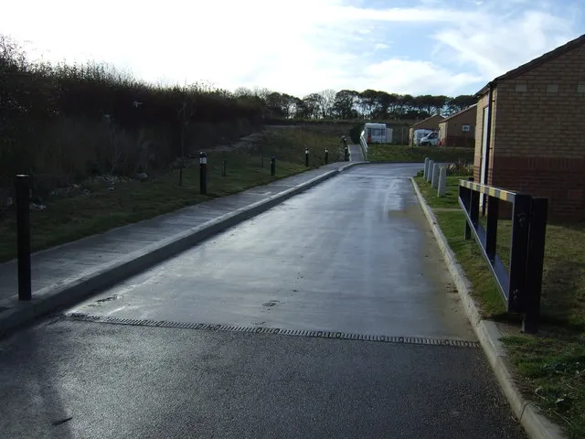
1. RoadSense Analytics: The Pothole Prophets of Bristol
The Problem Nobody Talks About
British drivers encounter an average of 32 potholes per mile on local roads, according to the Annual Local Authority Road Maintenance survey. Yet councils typically operate reactive maintenance programmes, responding to problems rather than preventing them. This approach costs UK authorities an estimated £12.8 billion annually whilst frustrating millions of motorists.
RoadSense Analytics, founded by former Bristol University engineering researchers, has developed what they term "predictive road degradation analytics." Their system combines satellite imagery, weather data, traffic volume statistics, and historical maintenance records to identify road sections likely to develop potholes within the next six months.
 Photo: Bristol University, via www.e-architect.co.uk
The Geospatial Magic
The company's artificial intelligence algorithms analyse micro-changes in road surface texture visible through high-resolution satellite imagery. By detecting subtle variations in asphalt colour and texture—imperceptible to human observers—their system identifies early-stage road deterioration before structural problems become apparent.
Crucially, RoadSense overlays this analysis with hyperlocal weather data, soil composition mapping, and traffic stress modelling. The result is a predictive maintenance system that allows councils to resurface roads before they fail rather than after complaints emerge.
South Gloucestershire Council, an early adopter, reports a 47% reduction in emergency pothole repairs since implementing RoadSense's recommendations. The technology has also identified previously unknown drainage problems that were accelerating road deterioration—issues that traditional inspection methods had missed entirely.
2. DarkSky Mapping: Scotland's Light Pollution Guardians
The Hidden Mental Health Crisis
Light pollution affects 83% of the global population, yet its impact on mental health and ecological systems remains poorly understood. Rural Scotland, with its scattered settlements and extensive dark sky areas, provides a unique laboratory for studying how artificial light affects human wellbeing.
DarkSky Mapping, based in Inverness, emerged from research into Seasonal Affective Disorder prevalence across the Highlands. Founders Dr. Sarah MacLeod and James Henderson discovered that light pollution levels—measured at incredibly granular scales—correlated more strongly with depression rates than traditional factors like population density or economic deprivation.
The Innovation
Their platform combines satellite-based light pollution measurements with ground-based sensor networks to create what they describe as "Scotland's first comprehensive artificial light atlas." The system tracks light pollution at 10-metre resolution across the entire country, updating measurements monthly to capture seasonal variations.
More innovatively, DarkSky Mapping has developed algorithms that predict how proposed developments will affect local light environments. Planning authorities can now assess whether new housing estates, industrial facilities, or retail parks will compromise existing dark sky areas before approving developments.
The Cairngorms National Park Authority uses DarkSky Mapping's data to guide lighting policies that protect both astronomical observation sites and wildlife migration corridors. Their analysis has influenced planning decisions affecting over £200 million worth of proposed developments.
 Photo: Cairngorms National Park, via web.archive.org
3. HeritageScan: Digital Archaeology for the Instagram Age
The Race Against Time
Britain loses an estimated 3% of its archaeological heritage annually to development, agriculture, and natural erosion. Traditional archaeological surveys are expensive, time-consuming, and often occur only after significant damage has occurred. Meanwhile, citizen archaeologists armed with metal detectors and smartphones are discovering new sites faster than professional archaeologists can catalogue them.
HeritageScan, founded by Cambridge archaeology graduates, has created what they term "crowdsourced archaeological intelligence." Their platform encourages amateur historians, metal detectorists, and countryside walkers to upload georeferenced photographs of potential archaeological features.
The Technical Breakthrough
The company's artificial intelligence system analyses uploaded photographs for archaeological indicators—unusual earthworks, building foundations, pottery fragments, or metalwork. Machine learning algorithms, trained on thousands of verified archaeological sites, can identify potential heritage assets with 78% accuracy.
More significantly, HeritageScan overlays this crowdsourced data with LIDAR surveys, historical maps, and planned development applications. The system automatically alerts Historic England, local archaeology units, and relevant planning authorities when potential heritage assets face imminent threats from development or agricultural activity.
 Photo: Historic England, via thumbs.dreamstime.com
Since launching in 2022, HeritageScan users have identified 1,247 previously unknown archaeological sites across England and Wales. Forty-three of these discoveries have influenced planning decisions, preventing irreversible heritage loss.
4. FloodWise Intelligence: The Water Level Whisperers
The Insurance Industry's £6 Billion Problem
British flood risk assessment relies heavily on Environment Agency flood maps that many insurance professionals privately acknowledge are inadequate. These maps, based on historical data and broad topographical analysis, fail to capture hyperlocal variations in flood risk that can affect individual properties differently within the same postcode.
FloodWise Intelligence, operating from a converted warehouse in Sheffield, has developed what they describe as "property-level flood risk analytics." Their system combines satellite-based elevation data, real-time river level monitoring, historical rainfall patterns, and urban drainage capacity modelling to assess flood risk at individual address level.
The Competitive Advantage
The company's breakthrough lies in their integration of Internet of Things sensors with satellite analytics. Their network of 2,400 sensors across British river catchments provides real-time water level data that feeds into artificial intelligence models predicting localised flooding events up to 72 hours in advance.
Crucially, FloodWise's algorithms account for urban microclimates and drainage system capacity—factors that traditional flood modelling often ignores. Their analysis can explain why one house floods whilst its neighbour remains dry, providing insights that transform both insurance pricing and flood defence planning.
Three major UK insurers now use FloodWise data to refine their pricing models, whilst twelve local authorities deploy their early warning systems to coordinate emergency responses.
5. VeggieVision: The Urban Agriculture Optimisers
The Food Security Challenge
Urban agriculture has expanded rapidly across Britain as communities seek greater food security and environmental sustainability. Yet most urban growing projects rely on guesswork rather than data when selecting crops, planning harvests, or optimising growing conditions.
VeggieVision, based in Manchester's Northern Quarter, applies satellite analytics to urban agriculture. Their platform uses multispectral imaging to monitor crop health, soil conditions, and microclimatic variations across allotments, community gardens, and urban farms.
The Agricultural Intelligence
The company's algorithms analyse vegetation indices derived from satellite imagery to identify optimal planting times, predict harvest yields, and detect plant diseases before they become visible to human observers. More innovatively, their system maps urban heat islands and air quality variations to recommend crop varieties suited to specific microenvironments.
VeggieVision also provides what they term "food mile optimisation"—analysing transport networks and consumer demand patterns to help urban growers maximise the local impact of their production. Their data has helped establish food supply networks that reduce average transport distances by 34% compared to conventional distribution systems.
Over 150 community growing projects across Greater Manchester now use VeggieVision's recommendations, collectively increasing yields by an average of 28% whilst reducing crop failures by 41%.
The Ecosystem Question
These five companies represent more than individual success stories—they demonstrate Britain's potential to lead global innovation in applied geospatial intelligence. Yet their experiences also highlight persistent challenges in the UK's startup ecosystem.
Access to high-quality geospatial data remains expensive and fragmented. Whilst the Ordnance Survey has made significant progress in opening government datasets, many innovative applications require commercial satellite imagery or specialised sensor networks that remain prohibitively expensive for early-stage companies.
Furthermore, British venture capital has been slow to recognise the commercial potential of geospatial applications. Investors familiar with software-as-a-service models often struggle to evaluate companies that combine hardware deployment, data analytics, and domain expertise in complex ways.
Building Tomorrow's Location Intelligence
Despite these challenges, Britain's geospatial startup sector shows remarkable creativity in addressing real-world problems through innovative applications of location intelligence. These companies succeed not because they pursue the largest possible markets, but because they understand specific problems intimately and apply sophisticated technology to solve them effectively.
Their collective impact suggests that Britain's geospatial innovation ecosystem may finally be maturing beyond academic research and government applications towards commercially viable solutions that improve daily life for millions of citizens. Whether this potential translates into sustainable competitive advantage will depend largely on continued investment in the technical infrastructure and risk capital that innovative geospatial companies require to scale their solutions nationally and internationally.