Trails Without Data: The Geospatial Deficit Holding Back Britain's Outdoor Recreation Economy
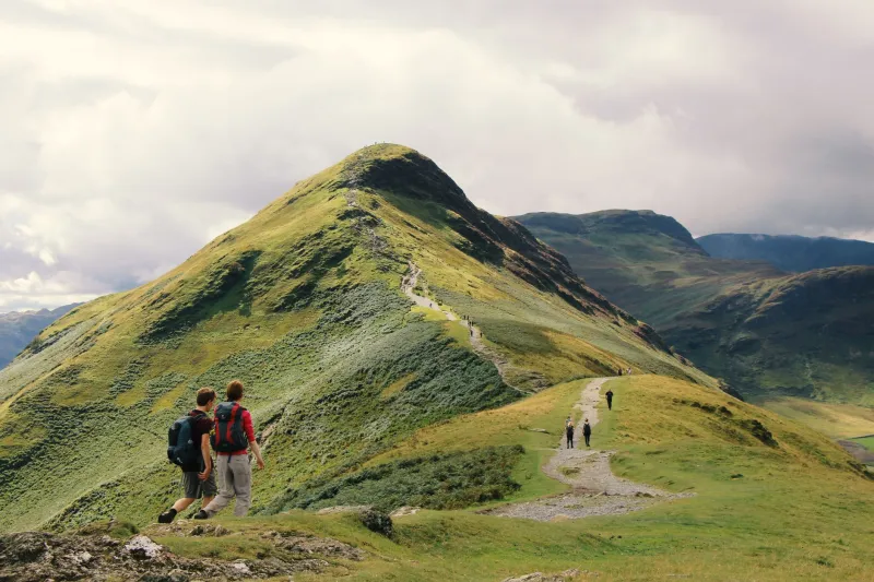
On a clear Saturday morning in the Lake District, Snowdonia, or the Cairngorms, the scale of Britain's outdoor recreation economy is immediately legible. Car parks overflow. Cafés queue out of doors. Boot shops do brisk trade. The hills are, in the most literal sense, alive with economic activity. What is less visible — and considerably less celebrated — is the degree to which that activity is navigated, managed, and supported by geographic information systems that are, in many cases, decades out of date.
Britain's outdoor recreation sector is estimated to contribute upwards of £20 billion annually to the national economy, encompassing walking, cycling, climbing, wild swimming, mountain biking, and a constellation of associated tourism activities. It is one of the few sectors in which the United Kingdom possesses both a world-class natural asset base and a deeply embedded cultural tradition of public access. And yet the geospatial infrastructure that underpins the management and promotion of that asset base lags far behind the sophistication of comparable sectors.
A Landscape of Incompatible Standards
The fundamental problem is fragmentation. Britain's outdoor recreation geography is administered across a bewildering array of organisations — Natural England, Natural Resources Wales, NatureScot, the Forestry Commission, National Park Authorities, local access authorities, canal and river trusts, cycling charities, and dozens of voluntary bodies — each of which maintains its own geographic datasets, frequently in formats and coordinate systems that are incompatible with those of their neighbours.
The Ordnance Survey's OpenData products provide a common topographic base, and the National Trails network is mapped with reasonable consistency. But below that level, the picture deteriorates rapidly. Trail condition data is collected by different bodies using different methodologies and stored in systems that do not communicate with one another. Surface type classifications vary between organisations. Accessibility information — gradient profiles, gate widths, stile heights — exists in some datasets and is entirely absent from others. Seasonal closures, maintenance works, and temporary diversions are communicated through a mixture of physical signage, organisation-specific websites, and social media posts, none of which feeds into any common spatial data layer.
For the individual walker or cyclist equipped with a consumer navigation app, this fragmentation is experienced as occasional frustration — a route shown as open that is in fact impassable, a ford that appears crossable on the map but has been flooded for three weeks. For the organisations responsible for managing the outdoor estate, and for the businesses whose livelihoods depend on directing visitors to appropriate destinations, it represents a more systemic failure with measurable economic consequences.
The Safety Dimension
Fragmented geographic data is not merely an inconvenience; in the outdoor environment, it carries genuine safety implications. Mountain rescue teams across Britain respond to thousands of incidents annually, a significant proportion of which involve walkers who have navigated using inaccurate or outdated route information. The relationship between poor location data and poor decision-making in challenging terrain is well established.
The technology to address this exists and is, in several respects, already deployed at small scale. Real-time trail condition monitoring using Internet of Things sensors — measuring surface moisture, temperature, and structural integrity — has been trialled on a handful of popular routes in Wales and Scotland. Satellite-derived terrain analysis can identify erosion patterns and surface degradation that would previously have required physical inspection. Mobile network coverage mapping, when integrated with route data, can identify the stretches of trail where users will lose connectivity and where emergency location sharing must be pre-configured.
The challenge is not technological. It is architectural. Each of these data streams currently exists in isolation, collected by different bodies for different purposes and held in systems that have no common interface. A walker entering the hills cannot access an integrated view of trail conditions, hazard alerts, and coverage gaps because no such integrated view has been assembled. The data to build it exists; the will to standardise it does not.
The Economic Case for Spatial Integration
The argument for a unified geospatial framework for Britain's outdoor estate is not merely operational. It is economic. The outdoor recreation sector's capacity to grow — to attract new participants, to extend the season, to distribute visitor pressure more equitably across the landscape — depends critically on the quality of the information available to visitors and to the businesses that serve them.
Consider the problem of spatial concentration. On any given bank holiday weekend, a small number of honeypot locations — Scafell Pike, Pen y Fan, Ben Nevis — absorb visitor volumes that their physical infrastructure cannot sustainably accommodate, whilst dozens of equally rewarding routes within the same geographic area receive a fraction of the traffic. This concentration is not simply a product of preference; it is a product of information asymmetry. Visitors navigate to the routes they have heard of because those are the routes for which reliable, accessible geographic information is available.
A dynamic, integrated spatial platform — one that combined real-time trail conditions, visitor density indicators, parking availability, and route difficulty profiles — could redistribute that demand in ways that benefit both the landscape and the local economy. Businesses in less-visited valleys would gain exposure. Erosion on overused paths would be reduced. Visitor safety would improve. The platform to deliver this is not beyond reach; it requires, above all, a commitment to common data standards across the organisations that collectively manage Britain's outdoor estate.
Learning from Comparable Jurisdictions
Britain is not without instructive comparators. Norway's national outdoor recreation data infrastructure, maintained through a partnership between the Norwegian Trekking Association and public mapping agencies, provides a single integrated layer of trail data accessible to all navigation platforms and updated in near-real time. Switzerland's SchweizMobil platform offers a similarly integrated approach to cycling and hiking route data, incorporating surface conditions, elevation profiles, and public transport connections in a format that is both technically rigorous and practically useful.
Neither model is directly transferable to Britain's institutional landscape, which is considerably more complex and more fragmented in its land management responsibilities. But both demonstrate that the ambition is achievable and that the economic returns — in visitor spending, in reduced rescue costs, in sustainable management of the natural environment — justify the investment in integration.
A Call for Common Ground
The Geospatial Commission's national strategy has rightly identified the outdoor environment as a domain in which improved location data could generate significant public value. What has been less forthcoming is a concrete mechanism for achieving the institutional alignment that a common geographic framework requires.
The case for action is not complex. Britain possesses an outdoor estate of extraordinary richness and an established cultural appetite for engaging with it. The geospatial tools to manage that estate more intelligently, more safely, and more equitably are within reach. What is needed is a recognition — from government, from the national park authorities, from the recreation charities, and from the technology sector — that the map is not merely a backdrop to the outdoor experience. It is the infrastructure upon which the entire economy of Britain's wild places depends. Getting that infrastructure right is not a technical afterthought. It is the foundation of everything that follows.