Green Space, Grey Data: Why Britain's Public Parks Are Disappearing From the Digital Map
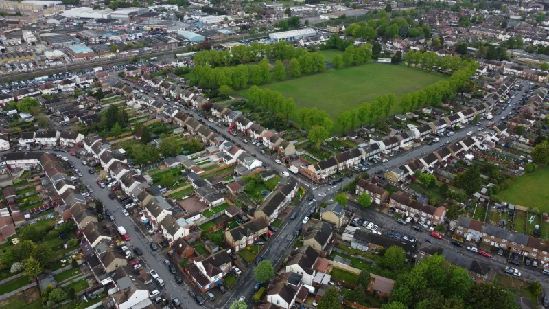
On a warm Saturday afternoon in a northern English city, a young family opens a mapping application on their phone and searches for the nearest park. The results show a large municipal recreation ground half a mile away — a reasonable option, but not the closest. What the application fails to show is the community pocket park that opened three years ago at the end of their street: a quarter-acre of lawned space, a modest play area, two benches, and a stand of silver birches planted by local volunteers. It is, by every meaningful measure, a public green space. It simply does not exist on the map.
This is not an unusual experience. Across Britain, from urban infill gardens to rural village greens, public green spaces are systematically underrepresented in the digital mapping infrastructure that now mediates how people navigate their environment. The consequences extend well beyond inconvenience.
The Scale of the Invisible Estate
Britain's publicly accessible green space estate is both larger and more fragmented than most people appreciate. Alongside the well-known urban parks managed by metropolitan councils, there are tens of thousands of smaller green assets: allotment sites, nature reserves, churchyard grounds open to the public, community orchards, urban commons, and the increasingly numerous pocket parks created through planning gain obligations and community land trust initiatives.
Fields in Trust, the charity that campaigns for the protection of public parks and green spaces, estimates that England alone has more than 27,000 parks and green spaces managed by local authorities. This figure does not account for the much larger number of smaller, informally managed or community-maintained spaces that occupy the grey zone between official designation and public accessibility.
Of this estate, a substantial proportion — estimates from open data researchers suggest it may be as high as a third — is either entirely absent from major commercial mapping platforms or represented with inaccurate boundaries, incorrect access information, or missing facility data. The smaller and more recently created the space, the more likely it is to be invisible.
Why Small Spaces Fall Through the Cartographic Net
The reasons for this omission are structural rather than accidental. Commercial mapping platforms — including those that dominate the UK market — derive their green space data from a combination of Ordnance Survey datasets, satellite imagery interpretation, and crowdsourced contributions. Each of these sources has characteristic blind spots when it comes to small urban green spaces.
Ordnance Survey's large-scale mapping products capture green spaces with reasonable completeness for larger parks, but smaller sites — particularly those created after the most recent survey cycle — may not appear until the next scheduled update. Update cycles for urban areas have historically been measured in years rather than months, meaning that a pocket park created as part of a housing development in 2021 may not appear in OS datasets until the mid-2020s.
Satellite imagery interpretation, meanwhile, is well-suited to identifying large vegetated areas but struggles with the small, often partially shaded spaces that characterise community green infrastructure in dense urban environments. A pocket park surrounded by terraced housing may simply read as a garden or a gap in building coverage — not as a public space accessible to all.
Crowdsourced data, such as that contributed to OpenStreetMap, offers the most responsive mechanism for capturing new and small green spaces, but contributions are unevenly distributed. Areas with active local mapping communities — which tend to correlate with higher levels of education and digital literacy — are well-served. Deprived urban communities and rural areas with lower volunteer engagement are systematically under-mapped.
The Public Health Dimension
The invisibility of green space on digital maps is not merely a data quality problem. It has measurable implications for public health, physical activity, and mental wellbeing — all of which have become central concerns for NHS England and the wider public health community.
Research published in the British Journal of Sports Medicine and elsewhere has consistently demonstrated that proximity to accessible green space is associated with higher levels of physical activity, lower rates of obesity, reduced stress, and improved mental health outcomes. The relationship is strongest when people are aware of and can easily locate nearby green spaces — a condition that digital mapping platforms are supposed to facilitate.
When those platforms fail to show a local park, the effective accessibility of that space is diminished even if its physical accessibility is unchanged. People who cannot find a green space through the tools they habitually use are, in practice, less likely to visit it. For households without cars — who are disproportionately concentrated in deprived urban areas — the difference between a visible nearby park and an invisible one may be the difference between regular outdoor activity and none.
Public health researchers have begun to quantify this effect. Studies examining the relationship between green space mapping quality and physical activity rates in English cities have found statistically significant associations between areas with poor green space data coverage and lower self-reported physical activity — even after controlling for the actual density of green space. The map, it seems, shapes behaviour as much as the landscape itself.
Local Authority Data and Its Limitations
One might expect local authorities, as the primary managers of public parks and green spaces, to maintain authoritative spatial datasets that could be used to populate mapping platforms. In practice, the picture is considerably more complicated.
A 2022 survey conducted by the Local Government Association found that fewer than half of English local authorities maintained a comprehensive, spatially referenced inventory of their green space assets in a format suitable for data sharing. Many councils rely on legacy systems — spreadsheets, paper records, and outdated GIS databases — that capture the existence of green spaces without providing the geometric boundary data required to represent them accurately on a map.
The situation has been worsened by more than a decade of local authority budget reductions, which have hit parks departments particularly hard. Staffing cuts have reduced the capacity for data maintenance, meaning that even authorities with nominally adequate systems may be working from records that have not been updated since the last major survey.
Citizen Cartography: Filling the Gaps
In the absence of authoritative data, communities are increasingly taking matters into their own hands. OpenStreetMap contributors across the UK have been systematically surveying and adding green spaces — including pocket parks, nature reserves, and community gardens — that are absent from commercial platforms. In cities including Bristol, Leeds, and Manchester, local mapping groups have organised dedicated green space mapping events, combining field surveys with analysis of planning records and community knowledge.
The London-based organisation Mapping for Change has worked with community groups in several London boroughs to produce participatory maps of local green space — maps that capture not only the physical extent of these spaces but community perceptions of their quality, accessibility, and safety. These projects have demonstrated that locally produced spatial data can be both more comprehensive and more nuanced than data derived from remote sensing or commercial surveys.
Several local authorities have begun to engage with these citizen-led initiatives, recognising that community mapping offers a cost-effective mechanism for improving their own green space inventories. Partnerships between councils and OpenStreetMap communities in Sheffield and Edinburgh have produced datasets that are now feeding into official planning systems — a model that geospatial professionals argue could be replicated nationally with appropriate coordination and funding.
Towards a National Green Space Register
The case for a nationally coordinated green space dataset — one that draws on local authority records, OS mapping, satellite data, and community contributions — has been made by a range of organisations, from Fields in Trust to the Royal Town Planning Institute. Such a register would provide a single authoritative reference for publicly accessible green space across Britain, enabling mapping platforms, health researchers, planners, and the public to work from a shared geographic foundation.
The Green Infrastructure Framework published by Natural England provides a conceptual basis for such an initiative, but implementation has been fragmented. The Geospatial Commission has identified green space data as a priority area for improvement, and pilot projects in several English regions have demonstrated the technical feasibility of integrating disparate sources into a coherent spatial dataset.
What has been lacking is the sustained commitment — financial and institutional — to take these pilots to national scale. In an era of constrained public budgets, green space data has struggled to compete for investment against more immediately visible infrastructure priorities.
Conclusion: Putting Green Space Back on the Map
The invisibility of Britain's public parks and green spaces in digital mapping systems is a quiet crisis — one that lacks the urgency of flooding or the drama of infrastructure failure but carries real costs for the communities it affects. Those costs fall disproportionately on people who are already disadvantaged: residents of deprived urban neighbourhoods, those without private gardens, and individuals for whom nearby accessible green space may be the primary opportunity for outdoor recreation.
The geospatial tools to solve this problem are available. The data exists, scattered across local authority systems, community surveys, and open mapping platforms, waiting to be integrated. What is required is the political will to treat green space data as essential public infrastructure — not a cartographic afterthought — and to invest accordingly in the systems that put it on the map.