The Silent Crisis Beneath Our Feet
Every eighteen minutes in Britain, a construction worker's shovel, excavator, or drill bit strikes a buried utility line. The consequences ripple outward like shock waves: gas leaks that force emergency evacuations, severed telecommunications cables that cripple entire business districts, and ruptured water mains that flood residential streets. In the worst cases, these accidental strikes claim lives.
Yet despite decades of technological advancement and billions invested in smart city initiatives, Britain's subsurface infrastructure remains largely invisible to those tasked with working around it. The nation's underground utility network—comprising millions of kilometres of gas pipes, water mains, telecommunications cables, and electrical conduits—exists in a fragmented patchwork of incomplete records, outdated paper maps, and incompatible digital systems.
The Price of Fragmentation
The financial toll of this mapping crisis extends far beyond immediate repair costs. Industry estimates suggest that utility strikes cost the British economy over £2.4 billion annually, encompassing emergency response, service restoration, business interruption, and infrastructure replacement. More troubling still are the human costs: Health and Safety Executive data reveals that utility strikes contribute to dozens of serious injuries and several fatalities each year.
"We're essentially asking construction crews to navigate a minefield whilst blindfolded," explains Dr Sarah Richardson, a geospatial systems analyst who has studied Britain's infrastructure mapping challenges for over a decade. "The information exists somewhere, but it's scattered across dozens of different organisations using incompatible formats and coordinate systems."
This fragmentation stems largely from the privatisation wave of the 1980s and 1990s, when formerly unified public utilities were carved up amongst competing private companies. Each new entity developed its own record-keeping systems, often prioritising operational efficiency over data standardisation. The result is a subsurface landscape where a single street might contain infrastructure owned by half a dozen different organisations, each maintaining separate—and often contradictory—location records.
Digital Archaeology in the Modern Age
The challenge extends beyond simple data coordination. Much of Britain's underground infrastructure predates modern surveying techniques, with some Victorian-era sewers and gas mains documented only through hand-drawn sketches and verbal descriptions passed down through generations of utility workers. Converting these historical records into precise digital coordinates requires painstaking forensic work that many utilities have been reluctant to fund.
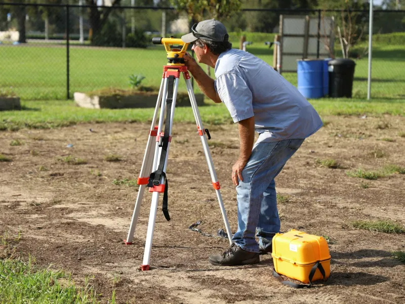
Contemporary mapping efforts face their own obstacles. Traditional surveying methods struggle with the density and complexity of modern urban environments, where multiple utility layers intersect beneath narrow streets lined with parked cars and bustling pedestrian traffic. Ground-penetrating radar, whilst increasingly sophisticated, cannot always distinguish between different types of buried infrastructure or provide the centimetre-level accuracy required for safe excavation planning.
Technological Solutions on the Horizon
Advanced geospatial technologies are beginning to address these longstanding challenges. Three-dimensional subsurface mapping platforms can now integrate data from multiple sources—including historical records, ground-penetrating radar surveys, and real-time sensor networks—to create comprehensive underground models. These systems use artificial intelligence to identify patterns and inconsistencies across different datasets, gradually improving accuracy through machine learning algorithms.
Particularly promising are emerging sensor technologies that can provide continuous monitoring of buried infrastructure. Smart sensors embedded within utility networks can track the precise location of pipes and cables whilst simultaneously monitoring their condition and performance. When integrated with advanced geographic information systems, this real-time data creates living maps that update automatically as infrastructure ages, shifts, or requires replacement.
Regulatory Momentum and Industry Resistance
Government recognition of the subsurface mapping crisis has intensified following several high-profile incidents. The Department for Transport has initiated consultations on mandatory underground asset registration, whilst Ofgem and Ofwat have begun incorporating data sharing requirements into utility licence conditions. However, implementation remains patchy, with many companies citing commercial sensitivity concerns and technical compatibility challenges.
The construction industry, meanwhile, has grown increasingly vocal about the need for comprehensive subsurface mapping. Major contractors now routinely budget significant contingencies for utility-related delays and complications, costs that ultimately filter through to consumers via higher infrastructure project expenses.
International Benchmarking
Britain's subsurface mapping challenges are not unique, but the nation lags behind several international peers in addressing them. The Netherlands has implemented a comprehensive underground cadastre that provides standardised location data for all buried infrastructure, whilst Singapore requires real-time updating of subsurface asset databases for all utility work. These examples demonstrate that technical solutions exist; the primary barriers remain organisational and regulatory rather than technological.
The Path Forward
Resolving Britain's subsurface mapping crisis requires coordinated action across multiple dimensions. Standardised data formats and coordinate systems must be mandated across all utility sectors, supported by government investment in data conversion and quality assurance programmes. Advanced geospatial technologies—including artificial intelligence, machine learning, and continuous sensor monitoring—offer the technical foundation for comprehensive subsurface mapping, but only if deployed within a coherent regulatory framework.
The stakes could not be higher. As Britain's infrastructure ages and urban development intensifies, the risks associated with incomplete subsurface mapping will only escalate. The choice facing policymakers is stark: invest in comprehensive underground mapping now, or continue paying the mounting costs—in lives and billions—of digging blind into the nation's hidden infrastructure network.