The Hidden Geography of Energy
Beneath the grey waters surrounding Britain lies the foundation of the nation's energy independence: millions of acres of seabed earmarked for offshore wind development. The UK government's commitment to 50GW of offshore wind capacity by 2030 represents one of the most ambitious renewable energy programmes globally. Yet this maritime revolution rests upon surprisingly shaky cartographic foundations.
Across British territorial waters, vast expanses of seabed remain unmapped to the precision standards required for modern offshore development. This marine mapping deficit isn't merely an academic concern—it's already driving up project costs, delaying installations, and creating unnecessary risks for developers, insurers, and ultimately, energy consumers.
Charting the Unknown
The scale of Britain's marine mapping challenge becomes apparent when examining coverage statistics. Whilst the UK Hydrographic Office maintains navigational charts covering all British waters, these focus primarily on shipping safety rather than the detailed geological and environmental data required for offshore wind development.
Current hydrographic surveys typically provide seabed resolution measured in metres, adequate for preventing ships from running aground but insufficient for positioning wind turbine foundations with the precision modern engineering demands. Offshore wind projects require centimetre-level accuracy across multiple data layers: seabed geology, sediment composition, archaeological features, existing infrastructure, and environmental sensitivity zones.
"We're essentially building critical national infrastructure on educated guesses about what lies beneath the waves," observes Dr Rebecca Thompson, marine geospatial specialist at the National Oceanography Centre. "The irony is that we map the surface of Mars with greater precision than large areas of our own continental shelf."
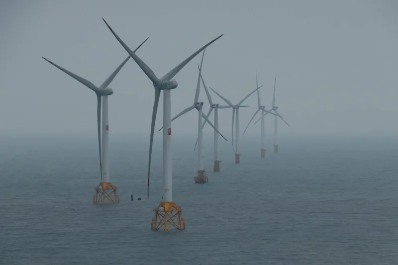
 Photo: National Oceanography Centre, via www.liddscaff.com
The Cost of Uncertainty
This mapping deficit translates directly into inflated project costs across the offshore wind sector. Developers must commission extensive site-specific surveys before construction, often discovering unexpected geological features, archaeological remains, or existing infrastructure that necessitates costly design modifications.
The Hornsea One project, at the time of construction the world's largest offshore wind farm, encountered precisely these challenges. Initial surveys based on existing hydrographic data suggested relatively uniform seabed conditions. Detailed pre-construction surveys revealed significant geological variations requiring modified foundation designs and adjusted turbine positions, adding an estimated £200 million to project costs.
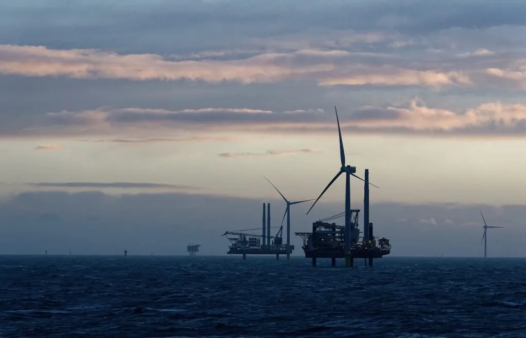 Photo: Hornsea One, via www.mareventusgroup.com
Similar scenarios play out across the sector. The Crown Estate, which manages seabed leasing rights, estimates that improved baseline mapping could reduce pre-construction survey costs by 30-40% whilst simultaneously reducing construction risks and delays.
Fragmented Data, Fragmented Planning
Beyond pure cost implications, fragmented marine mapping creates systemic planning challenges across the offshore wind sector. Multiple agencies maintain overlapping datasets with different standards, update cycles, and access protocols.
The UK Hydrographic Office provides navigational charts and basic bathymetric data. The Crown Estate maintains lease boundary information and some geological surveys from previous licensing rounds. Natural England and equivalent devolved agencies hold environmental sensitivity mapping. Historic England maintains underwater archaeological site records. The Maritime and Coastguard Agency tracks shipping routes and offshore installations.
Each dataset employs different coordinate systems, resolution standards, and data formats. Developers must manually reconcile these disparate sources, often discovering contradictions that require expensive verification surveys to resolve.
"Every offshore wind project begins with months of data archaeology before any actual archaeology," explains Mark Stevens, marine planning consultant with extensive North Sea experience. "Teams spend more time harmonising existing datasets than analysing the marine environment those datasets supposedly describe."
 Photo: North Sea, via cdn.pixabay.com
Environmental Planning in the Dark
The mapping deficit extends beyond engineering challenges to environmental planning and marine conservation. Strategic Environmental Assessments for offshore wind zones rely heavily on predictive modelling based on limited baseline data. When actual conditions differ significantly from mapped assumptions, environmental mitigation measures may prove inadequate or unnecessarily restrictive.
Recent studies of North Sea bird migration patterns, for example, revealed significant discrepancies between predicted and observed flight corridors through offshore wind zones. These discoveries necessitated costly modifications to turbine layouts and operational restrictions that could have been avoided with more comprehensive baseline mapping.
Similarly, marine mammal habitat mapping remains patchy across much of British waters. Offshore wind environmental impact assessments rely heavily on extrapolation from limited survey data, creating uncertainty for both developers and conservation organisations about the true environmental implications of proposed projects.
International Comparisons
Other maritime nations pursuing offshore wind development have adopted more systematic approaches to marine mapping. Denmark's national seabed mapping programme provides comprehensive geological, environmental, and archaeological data across all territorial waters, updated on regular cycles and freely accessible to developers.
The Netherlands has integrated marine spatial planning with continuous hydrographic surveying, creating a unified platform that supports offshore development whilst maintaining environmental protections and maritime safety standards.
These examples demonstrate that comprehensive marine mapping represents strategic infrastructure rather than regulatory burden. Countries with superior baseline data attract more offshore investment, experience faster project development timelines, and achieve better environmental outcomes.
Technology Solutions and Strategic Priorities
Modern surveying technology offers unprecedented capabilities for comprehensive marine mapping. Multi-beam echo sounders can map large areas rapidly with sub-metre resolution. Autonomous underwater vehicles can conduct detailed surveys in challenging conditions. Satellite-derived bathymetry provides cost-effective coverage for shallow waters.
The challenge lies not in technological capability but in institutional coordination and sustained investment. A truly strategic approach to marine mapping requires several key elements: standardised data formats across all agencies, regular update cycles reflecting the dynamic nature of marine environments, open access policies enabling private sector innovation, and dedicated funding streams recognising marine mapping as essential infrastructure.
The Path Forward
The UK's offshore wind ambitions depend fundamentally on understanding the marine environment where this infrastructure will operate. Current mapping deficits represent a strategic vulnerability that threatens both the pace and cost-effectiveness of renewable energy deployment.
Addressing this challenge requires recognising marine mapping as critical national infrastructure deserving sustained investment and institutional coordination. The technology exists to map British waters comprehensively. The question is whether government and industry will commit the resources necessary to build the geospatial foundation upon which Britain's energy future depends.
In an era where energy security has returned to the forefront of national policy, ensuring we truly understand the seabed that will power our future represents both strategic necessity and economic opportunity.