Between the Timetable and the Tarmac: The Rural Bus Stop Data Gap Stranding Passengers
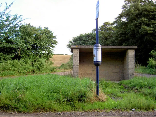
Photo: Steve F, CC BY-SA 2.0, via Wikimedia Commons
A bus stop is a small piece of infrastructure with an outsized role in rural mobility. It is where a timetable becomes a journey, where a request-only service becomes visible, and where a passenger decides whether to wait or give up. Yet in the digital systems that increasingly mediate public transport, the rural bus stop is often the weakest link. Timetables may be published, but the stop itself may be misplaced, unnamed, or missing from the real-time feed that tells passengers whether the bus is coming at all.
The Promise of Open Bus Data
England's Bus Open Data Service has made genuine progress since its introduction. Operators are required to publish timetables, fares, and location data in structured formats, and the result is a national resource that developers can use to build journey planners and live departure boards. For passengers in urban areas, the improvement is tangible: more routes are visible, more vehicles report their positions, and more apps can show a countdown to the next service.
But open data is only as good as its geographic foundation. A timetable that references a stop identifier is useful only if that identifier resolves to the right place on the ground. In rural areas, where stops are sparse, unnamed, or served by request-only services, that foundation is often shaky.
Where Rural Stops Fall Between Layers
Rural bus stops are frequently represented by a pole, a lay-by, or a informal marker rather than a shelter with a clear address. Some are served by services that stop only on request. Others are temporary interchanges created during roadworks or diversions. These are precisely the cases where location data tends to be weakest. A stop may appear in an operator's timetable data but not in the local authority's asset register. A temporary stop may be published in a PDF notice but not in the machine-readable feed. A request-only service may be omitted from a journey planner because it cannot be represented as a conventional fixed stop.
The consequence is a gap between the timetable and the tarmac. A passenger standing at a rural stop may be invisible to the app, even though the bus is scheduled to pass. A visitor may be directed to a stop that no longer exists. A council may believe it has published its network while residents cannot find their own service.
Request-Only Services and the Visibility Problem
Request-only services are a lifeline in sparsely populated areas, but they sit awkwardly within standard transport data models. They may require a phone call, a pre-booked pickup, or a flag-down gesture. If the data model assumes every stop is a fixed point with a fixed timetable, these services become second-class citizens. The location of the pickup point may be approximate, the service may not appear in real-time feeds, and the passenger may have no way to confirm that the bus will stop.
A better approach would treat request-only services as a distinct service type with their own location and contact attributes. That would allow journey planners to show them without pretending they are conventional fixed-line stops. It would also give transport authorities a clearer picture of where rural access depends on flexible provision.
Temporary Interchanges and the Cost of Drift
Temporary stops are another weak point. Roadworks, bridge closures, and event diversions can move a stop by hundreds of metres for weeks or months. If the temporary location is not published in the same machine-readable system as the permanent one, passengers are left to rely on posters and local knowledge. For disabled passengers, a moved stop can mean an inaccessible detour. For anyone without a smartphone, it can mean missing the bus entirely.
Geospatial ground-truthing is the obvious corrective. Transport authorities and operators need a routine process for verifying stop coordinates, names, and accessibility attributes against the physical network. That process should include temporary and request-only stops, not just the permanent estate. It should also capture the difference between a stop flag, a shelter, and a boarding point, because those distinctions matter to passengers with mobility impairments.
Ground-Truthing as a Complement to Franchising
Franchising reforms in England have focused attention on network planning, fares, and service standards. Those are important, but they will not fix a data problem on their own. A franchised network still needs an accurate stop register, and a combined authority still needs to know where its vehicles actually stop. Geospatial ground-truthing should be treated as part of the reform agenda, not an afterthought.
That means funding local transport data teams, setting minimum accuracy standards for stop coordinates, and requiring operators to publish temporary changes in the same format as permanent ones. It also means involving rural communities in verification, because they know where the bus really stops when the map does not.
Britain's rural passengers are not asking for a perfect real-time feed at every isolated lay-by. They are asking for the digital network to reflect the physical one. Until the bus stop that is not there becomes visible in the data, open transport information will remain a partial promise.