Drowned in Data Gaps: The Flood Risk Mapping Crisis Leaving Britain's Most Vulnerable Households Exposed
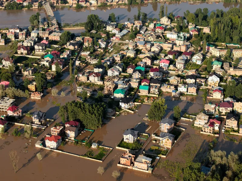
Every winter, flood alerts ripple across the Environment Agency's warning network, prompting the familiar television footage of sandbags and wading residents. What the cameras rarely capture is the quieter crisis unfolding in local authority planning offices, mortgage brokers' inboxes, and insurance underwriting rooms — a crisis rooted not in rainfall, but in the accuracy and completeness of the geographic data underpinning Britain's entire approach to flood risk management.
The United Kingdom has invested considerably in flood modelling infrastructure. The Environment Agency's National Flood Risk Assessment, supplemented by the Long Term Flood Risk mapping portal, represents a genuine technical achievement. Yet the data architecture supporting it remains inconsistent, temporally uneven, and — crucially — insufficiently granular to reflect how flooding actually manifests across Britain's extraordinarily varied built environment.
A Map That Moves Slower Than the Water
Flood risk is not static. Land subsidence, urban expansion, changing drainage patterns, and the accelerating effects of climate change mean that a property assessed as low-risk in 2005 may sit in a materially different hydrological context today. Yet significant portions of the Environment Agency's surface water flood modelling rely on terrain data and drainage records that have not been comprehensively updated since the mid-2000s.
The agency's own documentation acknowledges that detailed modelling is concentrated on watercourses with catchment areas exceeding three square kilometres. Smaller watercourses — the brooks, becks, and drainage channels that thread through market towns, housing estates, and agricultural lowlands — are frequently absent from the national dataset, or represented only by simplified approximations. For the households adjacent to these minor watercourses, official low-risk classification is less a guarantee of safety than a cartographic artefact.
This is not merely an academic concern. Mortgage lenders increasingly rely on Environment Agency flood zone designations when making lending decisions. Properties in Flood Zone 3 — the highest risk band — face restricted mortgage availability and substantially elevated insurance premiums. But properties that sit outside formal flood zones yet flood repeatedly are caught in a peculiar administrative limbo: too risky for insurers who have access to proprietary claims data, yet apparently safe according to the official maps that lenders consult.
The Insurance Data Divide
Britain's major insurers have, over decades, assembled loss-experience datasets of considerable sophistication. Companies such as Flood Re — the government-backed reinsurance scheme established in 2016 — operate from actuarial models that frequently diverge from the Environment Agency's publicly available classifications. This divergence is not incidental. It reflects the fundamental difference between a regulatory mapping exercise and a commercial risk-pricing model.
The consequence is a two-tier information landscape. Households in well-documented flood zones receive clear, if unwelcome, guidance. Those in areas where official maps diverge from insurer experience encounter contradictory signals: their local authority planning portal may show no flood risk, while their home insurer quietly loads their premium or declines to renew their policy. Without access to the proprietary data driving that decision, affected residents have little recourse and limited understanding of their actual exposure.
Small and medium-sized towns in Yorkshire, Somerset, and the Welsh Marches — areas with complex drainage geographies and a history of localised flooding — are disproportionately represented in this category. These are frequently communities with older housing stock, lower average incomes, and residents who are least equipped to absorb the financial shock of an underinsured flood event.
Local Authority Records: The Missing Layer
Beyond the national dataset, local authorities hold a further body of flood-related geographic intelligence: historical flood records, surface water drainage surveys, planning condition monitoring, and records of previous insurance claims submitted to lead local flood authorities. This information is inconsistently digitised, rarely standardised, and almost never integrated with the national mapping layer.
The Flood and Water Management Act 2010 charged lead local flood authorities with maintaining registers of flood risk assets. Over a decade later, the quality and completeness of those registers varies enormously between councils. Some authorities have invested in sophisticated GIS infrastructure capable of integrating multiple data sources into coherent local flood risk models. Others maintain records in legacy spreadsheets, paper archives, or not at all.
This inconsistency has direct implications for planning. A developer seeking to assess flood risk for a proposed housing scheme on the urban fringe will consult the Environment Agency portal, which may show the site as low-risk, while the local authority holds drainage survey data suggesting the opposite. Unless the developer commissions independent hydrological modelling — an expense typically reserved for larger schemes — that discrepancy may never surface.
Granularity and the Geography of Vulnerability
Perhaps the most significant structural limitation of Britain's current flood risk mapping framework is its spatial resolution. The Environment Agency's indicative flood plain mapping operates at a scale appropriate for strategic planning but inadequate for property-level decision-making. A flood zone boundary drawn at one-in-one-hundred-metre resolution can place adjacent properties in categorically different risk classifications, with profound consequences for mortgage availability and insurance cost.
For households on the boundary — a situation that affects tens of thousands of properties — the classification is effectively arbitrary, determined more by the precision of the modelling methodology than by meaningful differences in physical exposure. High-resolution LiDAR data, which the Environment Agency has gathered extensively across England, offers the technical basis for substantially more accurate delineation. The challenge is not data collection but data integration and the political will to update classifications that will, inevitably, reclassify some properties upward.
Towards a Unified Geospatial Flood Framework
The path forward requires more than incremental updates to existing datasets. It demands a genuinely integrated approach to flood risk geography — one that combines Environment Agency modelling, local authority records, insurance loss data, and real-time sensor networks within a single, openly accessible spatial framework.
Several European comparators offer instructive models. The Netherlands, whose existential relationship with water management has driven sophisticated geospatial investment, maintains a national flood risk atlas updated on a rolling basis and accessible at property level. France's Géorisques platform integrates multiple natural hazard datasets — including flood risk — within a unified geographic interface that feeds directly into property transaction processes.
Britain is not without the technical capacity to build equivalent infrastructure. The Ordnance Survey's National Geographic Database, combined with the Environment Agency's existing LiDAR holdings and the address-level precision of the National Address Gazetteer, provides a credible foundation. What has been absent is the institutional coordination and sustained investment necessary to translate that capacity into a coherent national resource.
For the households currently navigating contradictory risk signals — unable to secure affordable insurance, struggling to sell properties that official maps declare safe — that coordination cannot arrive soon enough. Flood risk is, at its core, a geographic problem. Britain's response to it must be grounded in geographic data that is precise, consistent, and honest about what it does not yet know.